Maps help us see the world but they’re not the same size as the places they show. That’s where scale factor comes in. For middle school geography students, a scale factor map worksheet is a hands-on way to practice turning map distances into real-world distances. It’s not just math on paper it’s how you figure out how far it really is from your town to the nearest national park, or how big a country looks compared to another.
What does “scale factor” mean on a map?
Scale factor is a number that tells you how much a map shrinks (or enlarges) the real world. If a map has a scale factor of 1:100,000, then 1 cm on the map equals 100,000 cm (or 1 km) on the ground. It’s a ratio not a measurement unit by itself. Students often mix up scale factor with map scale written as a fraction or bar scale, but they all point to the same idea: consistent shrinking for accuracy.
When do middle schoolers use these worksheets?
Teachers use scale factor map worksheets during units on maps and globes especially when introducing how to read topographic maps, plan field trips, or compare countries on a world map. You’ll see them in lessons about distance calculation, map reading skills, and even early cartography basics. A common activity is measuring the distance between two cities on a map and using the scale factor to find the real driving distance.
What’s on a typical scale factor map worksheet?
Most include a simple map with a clear scale bar or ratio, a ruler (or instructions to use one), and questions like: “How many kilometers is it from Chicago to St. Louis on this map?” or “If the scale factor is 1:50,000, how far apart are these two towns in real life?” Some also ask students to draw a new map using a different scale factor helping them see how changing the factor changes the map’s size but not its accuracy.
Common mistakes and how to avoid them
- Forgetting to convert units: Students measure in centimeters but forget to change kilometers to meters or centimeters before multiplying. Always write down the units and cancel them out step by step.
- Misreading the scale: A scale of 1:25,000 means 1 unit on the map = 25,000 of the same units on land not 25,000 km or miles unless specified.
- Using the wrong operation: Scale factor is a multiplier, not an adder. To get real distance, multiply map distance × scale factor not add or divide.
How to check if your answer makes sense
Before turning in your worksheet, ask: “Does this distance match what I know?” If your calculation says New York to Boston is 30 km, double-check you know it’s closer to 350 km. Estimating first helps catch big errors. You can also try reversing the math: take your real-world answer and divide by the scale factor to see if you get back close to your original map measurement.
Where to find more practice
If your class uses a standard curriculum, you might already have access to the dedicated scale factor map worksheet for middle school geography class. For extra support with calculations, try the worksheet focused on converting map distances to real ones. And once students are comfortable with local maps, the world map scale factor application worksheet helps them compare continents and oceans using consistent ratios.
One helpful tip: Keep a small reference sheet taped inside your geography notebook with common conversions (1 km = 100,000 cm; 1 mile ≈ 160,934 cm) and a reminder that scale factor always applies equally in all directions on the map. Also, use a clean, readable font like Avenir Next when printing or typing your own practice sheets it reduces eye strain during long measurements.
Next step: Grab a printed map from your textbook or atlas, pick two points, measure the distance with a ruler, then use the map’s scale to calculate the real distance. Write down each step even the units and check your work with a quick online search for the actual distance.
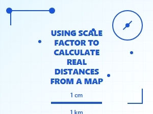 Using Scale Factor to Calculate Real Map Distances
 Mastering Map Scale Factor Practice Problems
 Applying Map Scale Factors to Real-World Problems
 Comparing Original and Scaled Dimensions
 Mastering Scale Factor Word Problems and Solutions
 Applying Scale Factors to Real-World Scenarios